MAPS

One for each community of Astoria and Warrenton, these visitor maps show major roads, attractions and important sites making it very easy to find your way around while in town or to plot out your visit while in planning stages.
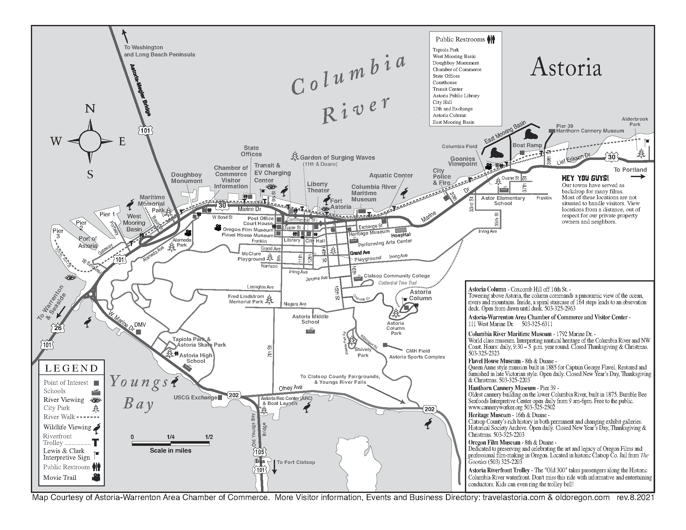
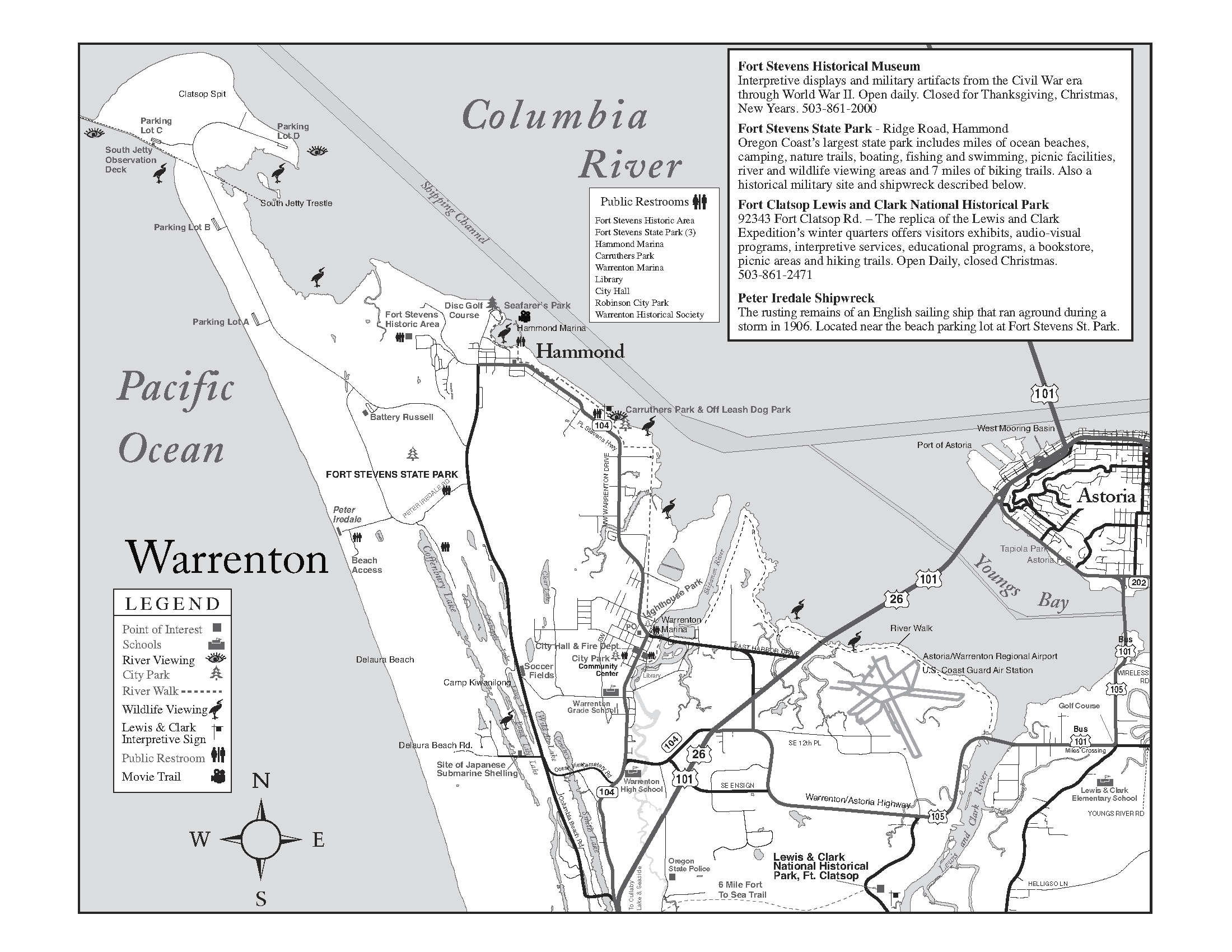
Astoria & Warrenton Visitor Map (2 pages)
How to Get Here
Use
Google Maps to find directions from your starting point.
By Car
Astoria and Warrenton are about two hours from Portland and three hours from Seattle.
By Bus
Operated by Oregon Coachways, the NorthWest POINTwill run two roundtrips per day with morning and evening departures from both Astoria and Portland, seven days a week. Visit
Northwest Point for schedules, fares and other information.
The Northwest Connector is an alliance of transit agencies across NW Oregon, that connect and coordinate to meet your transportation needs. Serves the Coast between Astoria and Yachats, and into the valley including Rainier, Portland and Salem. This is a great option for
car-free travel into and around this area.
By Air
The
Warrenton - Astoria Regional Airport is suitable for private planes of any size.
The
Portland International Airport is about 2 hours away from Astoria and the
Seattle-Tacoma International Airport is about 3.5 hours away.
By Boat
The
City of Warrenton operates the Hammond and Warrenton marinas and the
Port of Astoria operates two marinas in Astoria with moorage for visiting boaters.
Local Transportation
Sunset Empire Transportation District offers routes throughout Astoria and Warrenton, Seaside and Cannon Beach year-round.
The NW Connector combines the services of SETD with connecting routes and provides a great option with a multi-day pass.
Travel Conditions
Please check out the Oregon Department of Transportation’s
TripCheck for road conditions that may affect travel due to construction or weather.
Travel Astoria and Warrenton
111 West Marine Drive
Astoria, Oregon 97103
503-325-6311
View 111 W Marine Dr in a larger map